Book your Charlotte Pass vacation
Book now
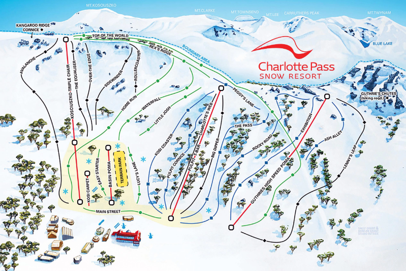
Charlotte Pass trail map is a detailed map of the ski runs and terrain available at Charlotte Pass ski resort in New South Wales, Australia. The map shows the layout of the resort, including the location of lifts, ski runs, and facilities such as restaurants, ski schools, and rental shops. The trail map is color-coded to indicate the difficulty level of each ski run, with green representing the easiest runs, blue representing intermediate runs, and black representing the most difficult runs. The map also shows the location of terrain parks, which cater to freestyle skiers and snowboarders. In addition to the ski runs, the Charlotte Pass trail map also shows the location of cross-country ski trails, snowshoeing trails, and other winter activities available at the resort. The map includes important safety information such as the location of ski patrol stations, emergency services, and restricted areas.
Download MapNavigate the slopes of Charlotte Pass like a pro with our extensive collection of trail and village maps.
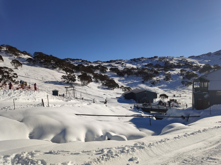
Charlotte Pass is located in the Kosciuszko National Park, New South Wales, Australia. It is approximately a 20-minute drive along the Kosciuszko Road from Perisher and 30 minutes from Jindabyne.
June - October
Kosciuszko National Park NSW 2627
www.charlottepass.com.au/
@charlottepass_snow
Top Elevation | 1954m |
Base Elevation | 1765m |
Avearage Snow | 2.8m |
Skiable Terrain | 50ha |
Lifts | 5 |
Gondolas | 0 |
Park | Available |
Beginner | 30% |
Intermediate | 50% |
Expert | 20% |