Book your Fernie vacation
Book now

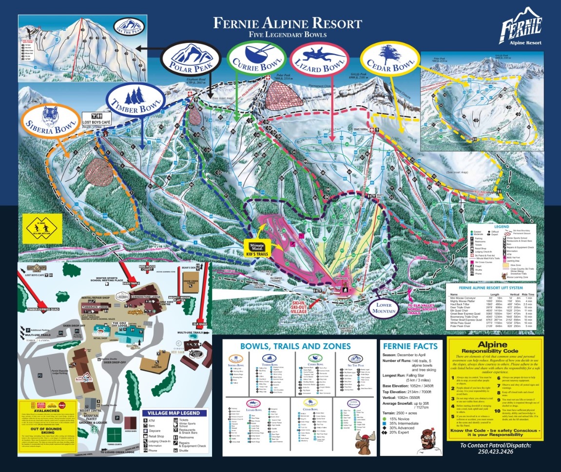
The Trail Map is your resource for run and lift information.
Download Map
Base Area Map to view on mountain parking, retail, dining and more.
Download Map
View this map for more information on Fernie Alpine Resort's Cross Country Ski, Snowshoe and Winter Fat Biking routes.
Download Map
View this map for more information on Fernie Alpine Resort's Cross Country Ski, Snowshoe and Winter Fat Biking routes.
Download MapNavigate the slopes of Fernie like a pro with our extensive collection of trail and village maps.
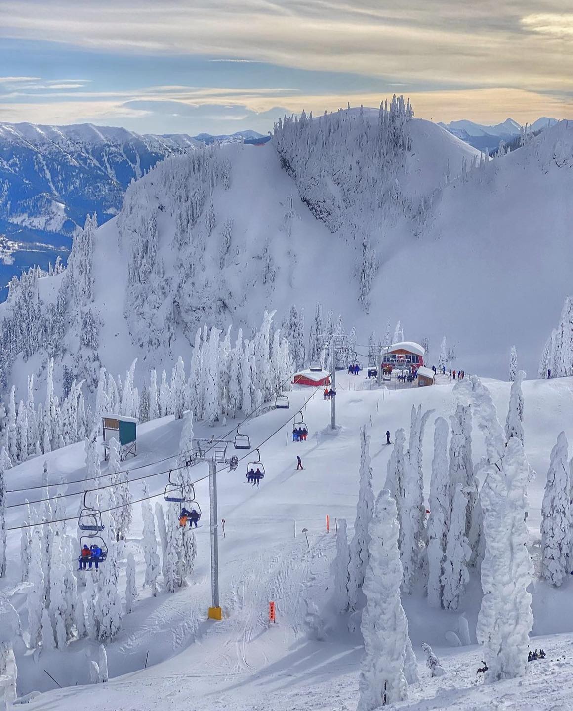
Fernie Alpine Resort is located in the Lizard Range of the Canadian Rocky Mountains. The Calgary International Airport is 3.5 hours from Fernie and there are shuttle options to get to the resort. Cranbrook Airport (Rocky Mountain Airport) is 1.25 hours away, and Kalispell in Montana is 2 hours away.
December - April
5339 Fernie Ski Hill Rd, Fernie, BC V0B 1M6, Canada
skifernie.com/
@ferniealpineresort
Top Elevation | 1925m |
Base Elevation | 1068m |
Avearage Snow | 8.75m |
Skiable Terrain | 1013ha |
Lifts | 10 |
Gondolas | 0 |
Marked Trails | 142 |
Park | Available |
Longest Run | 5km |
Beginner | 30% |
Intermediate | 40% |
Expert | 30% |